With ArcGIS you have the possibility of creating a fishnet of rectangular cells and the output can be polyline or polygon features.
To create a fishnet grid using ArcGIS 10, let’s follow the next steps:
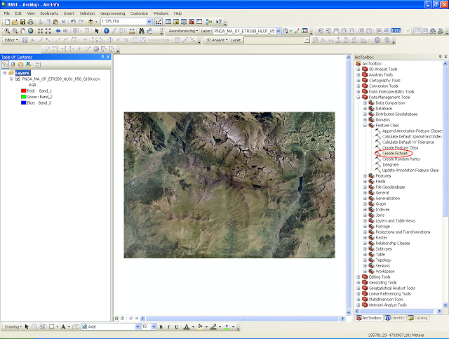
- Open Arcmap and once the coordinates system of the Data frame have been selected, open ArcToolbox.
- Select the tool Create Fishnet. This tool is located in Data Managment Tools > Feature class > Create Fishnet.
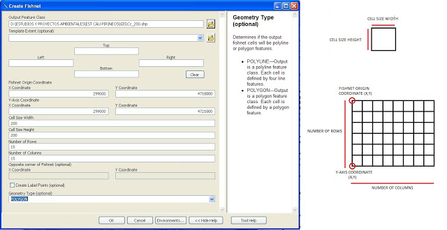
In the dialog box, first select the location of the file or shape of the grid. Then, you will have to define the following characteristics:
- Fishnet origin coordinate: these are the coordinates that definde the origin point of the gris. They correspond to the superior left corner of the grid (see following image)
- Y-axis coordinate: these are the coordinates of the point that define the Y-axis of the grid. They correspond to the inferior left corner of the grid (see following image)
- Cell size width
- Cell size height
- Number of rows
- Number of columns
- Grid geometry type: polyline or polygon (select polygon)
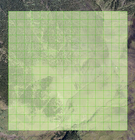
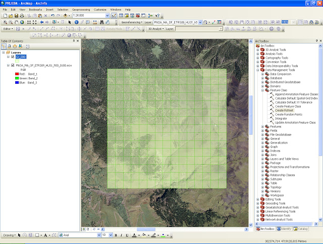
After executing the tool we will obtain the defined grid. These grids are very useful to create density maps for species spotted, mortality rates, etc. In the upcoming entries we will talk about creating density maps based on this type of grids so keep an eye!.
Quality training taught by professionals
RECOMMENDED COURSE


Thanks