The ArcGIS Course applied to Geology and Mining is particularly suitable for professionals in these areas who want to gain an advanced knowledge of this powerful software, and specifically of those tools that are very useful to the fields of geology and mining.
Let’s review in this post some of the most interesting contents regarding the course:
Learn about international cartographic information sources applicable to geology and mining.
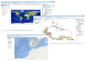
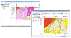
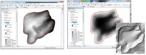
Use ArcGIS to georeference geological maps from scanned documents or similar.
Generate a layer with field data obtained during samplings and representing the chemical concentration values. Automatic calculations of the samplings in each lithology and other useful calculations for geological reports.
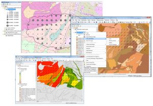
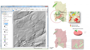
Generate grid sampling with the location of quarries and the following representation in quantity maps.
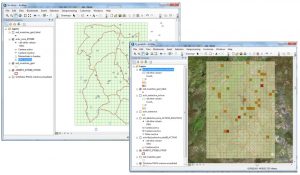
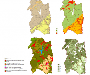
Do simple multi-criteria analysis to locate an arid exploitation according to several legal, geological and logistic factors such as lithology, distance to protected areas, easy access, etc.
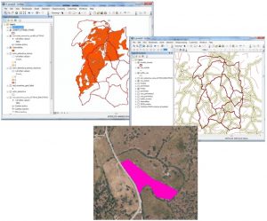
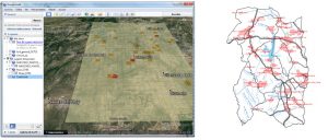
Export files to several formats: Google Earth, CAD, vector – raster, etc.
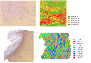
Create Digital Terrain Models (DTM) from contour lines and vertex taking into account shapes of reliefs like rivers, basins, etc. Generate DTM from ASCII files obtained from the National Geographic Institute (IGN, Spain).
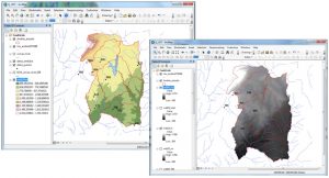
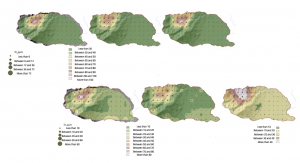
Generate contour lines, slope maps, hill shade maps and orientation maps.
Generate a digital terrain model of a quarry before its exploitation and after using topographic information and delineation data of the final state of the quarry.
Modify a digital terrain model to introduce different urban elements to subsequently analyse the visibility of the quarry from the closest population areas.
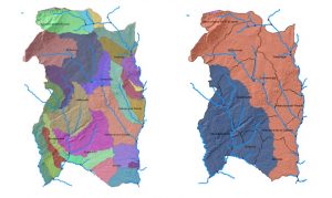
Make hydrologic analysis such as concentration and flux direction maps, obtain drainage networks and classify rivers, hydrological basins and outlets.
Create geochemical maps from punctual field data through different interpolation techniques.
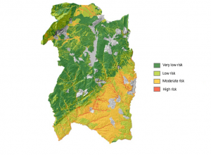
Carry out complex multi criteria analysis with raster data models to analyse erosion and landslide risks.
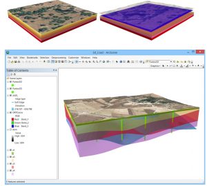
Generate 3D simulations of geological cuts using ArcScene.
Quality training taught by professionals
RECOMMENDED COURSE


Please Show us how to apply remote sensing for Forest Biomass carbon stock assessment?
Want to do this course
Hello!
Send an e-mail to training@tycgis.com for more details. Thank you!