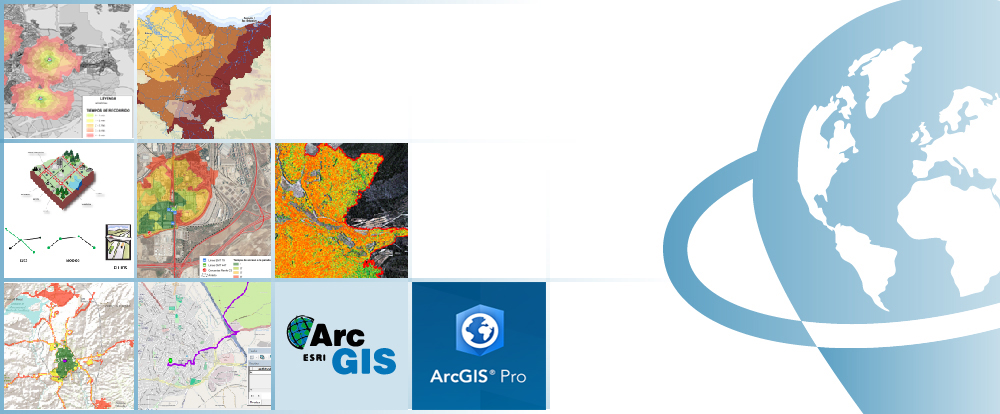
ARCGIS PRO COURSE, HOW TO USE NETWORK ANALYST EXTENSION
ONLINE TRAINING
START DATE: Available Soon
PRICE: 240€ (Standard fee) | 216 (Student / Unemployed fee)

This course will qualify students in ArcGIS PRO, particularity in the development of projects related to transport networks (roads, channelization, optimal routes, quickest way to get from point A to point B, accessibility issues, identifying a service area around a location, determine the least-cost network paths between several origins and destinations, etc.)
Network Analyst extension, offer the possibility to design a transport network (for private car, buses, for railway, metro, etc.) from scratch. They will learn how to perform accessibility studies, using different networks. Also they will be able to create a logical network system and calculate the best route, determine service areas, closest facilities, perform origin-destiny cost matrix and location-allocation analysis, determine vehicle routing problems.
Enrolled students in this online course will have access to our virtual e-learning platform (which is available 24 hours), where they will find the content of the course, practical exercises, forum discussion and additional content. One of the advantages of this online platform, is that students can benefit of real time support and assistance offered by the instructor (2 hours per week), whom they can contact via direct messages, regarding course related issues, at any moment. They can also contact the instructor via email.
- Highlight the importance and utility of a Geographic Information Systems (GIS) especially in the elaboration of transport network studies, network analysis, accessibility issues.
- Design, manage and analyse a transport network, learn and integrate concepts such as commercial speed, accessibility and impedance.
- Gain the needed knowledge to generate impedances and attributes according to the type of network.
- Understand all the essential concepts needed for an advanced use of ArcGIS PRO Network Analyst extension.
- Obtain the best route plan, optimal location, accessibility analysis, etc.
- Design tools using Model Builder and apply them to network analysis.
- Study geomarketing concepts and perform essential analysis.
1 - INTRODUCTION TO NETWORK ANALYSIS WITH NETWORK ANALYST
- Definition.
- Network Types
– Geometric
– Transport. - Logical Network.
- Network composition
– Nodes
– Axis
– Flow
Guided exercise 1: Identify the types of networks and its components.
2 - DESIGN OF A NETWORK
- Digitise a specific network.
- Required attributes for a transport network (frequency, commercial speed, distance) .
- Network topology.
Guided exercise 2: Create a simple bus network, fill in the necessary attributes and evaluation.
3 - NETWORK ANALYST EXTENSION COMPONENTS
- Network Analyst workflow.
- Network Analyst toolbar in ArcMap.
- Network Analyst window in ArcMap. Identifying a Network in ArcCatalog.
- Identifying a Network in ArcCatalog.
- Network symbology.
Guided exercise 3: Activate the network analyst extension, Windows preparation and getting used to the Network Analyst toolbar in ArcMap and evaluation.
4 - GENERATING A NETWORK DATASET
- Creation and editing of spatial data.
- Layers selection.
- Allowed turns and turn tables.
- Connectivity policy.
- Overpasses policy.
- Impedances
– Cost
– Descriptors
– Restrictions - Directions Windows.
- Definition of Network Analyst in ArcCatalog for specific mapping.
Guided exercise 4: Generating a turn layer, generating the needed attributes for an overpass, description of impedances and evaluation.
5 - GENERATING A NETWORK WITH COMMERCIAL MAPPING
- Advantages of using commercial mapping (HERE Nokia) and Arctoolbox Street Data processing (specific impedances).
- Identifying attributes (signals, turn restrictions, speed, travel duration, etc.).
- Generating a Network DataSet with ArcToolBox for commercial mapping (Street Data processing).
- Definition of Network Analyst in ArcCatalog for commercial mapping.
Guided exercise 5: Generating a Network Dataset with ArcToolBox Street Data processing with commercial mapping of Colmenar Viejo (Madrid, Spain) and evaluation (Hoyo de Manzanares, Madrid, Spain).
6 - NETWORK ANALYSIS
- Network Analyst toolbox bar in Arcmap.
- Best route analysis.
- Service area analysis. Isochrone maps or accessibility times.
- Closest facility installation.
- Origin – Destiny Matrix Analysis.
- Vehicle routing problem analysis. Fleet analysis .
- Location – allocation analysis. Pick up / delivery routes.
Guided exercise 6: Best delivery route for pharmacies, geomarketing study of clients for repair shops, accessibility to public transportation stops, etc.). and evaluation.
7 - PRACTICAL APPLICATIONS FOR DIFFERENT TRANSPORT NETWORKS
- Territorial accessibility by private car.
- Territorial accessibility by public road transport.
- Coverage of the public transport stops (dispersion of time).
- Public transport network optimization. Lines and stops.
- Acessibility by railway transport.
Guided exercise 7: About accessibility (mapping interpretation) and evaluation.
8- GENERATING NETWORK GEOPROCESSING TOOLS WITH MODEL BUILDER
- Introduction to Model Builder.
- Automating the process to calculate influence areas of public transport stops.
- Automating the process in the calculation of optimum locations.
Guided exercise 8: Generating a tool and evaluation.

Ricardo García Álvarez
With more than 15 years experience in the cartography and geographic information systems sec-tor, Ricardo holds a Bachelor´s degree in Geography from the Universidad Autonoma de Madrid and a Master in Geographic Information Systems from the Universidad Pontificia de Salamanca.
Ricardo has experience in transport networks project management, spatial accessibility studies with GIS, sustainable urban mobility plans, traffic studies (macro and micro simulation) and car-tography development ( orthorectification, digital restitution and photogrammetric consulting).
As a teacher, he has given internal training courses for companies such as Tragsa (Tragsatec Group) or Prointec (Indra Group).
Why study ArcGIS Pro?
The usage of Geographic Information Systems (GIS) is rapidly growing, becoming an essential tool in a variety of business sectors like engineering, environment, geography, mining or geomarketing.
Among GIS tools, ArcGIS is one of the most used GIS software worldwide, the most stable and versatile, comprised by a set of integrated applications, with a solid documentation over a wide range of tools being also supported by a large community.
ArcGIS provides contextual tools for data visualization, mapping and spatial analysis, connecting and combining information from varied sources (local and online), offering complex capabilities in order to explore, gain and enquire knowledge, that will lead to the best decisions. It can be also handled using a user interface as well as in command line using specific programming languages, like Python.
Do I need previous knowledge in ArcGIS Pro?
Yes, you need to have knowledge similar to that taught in the ArcGIS Pro – Beginner Level Course.
I don’t have the ArcGIS Pro program. What can I do?
ArcGIS PRO software has a free trial license for a period of 21 days. You only need to create an account, download the program and follow the installation steps (see the website). However, we will assist you if you encounter any problem.
Our online courses, are distributed via Moodle, the world’s most popular learning platform. It is a highly flexible Learning Management System that can be used to conduct and access courses, accomplish tasks of practical exercises, interact face-to-face to the teaching staff or benefit of support and resources at any time.
The online platform can be accessed 24 hours a day, in which the student will be able to ask for help at any given moment. The instructors will act as supervisors during all the training process, offering support for any possible difficulty encountered by the students along the course.
The course is structured in different modules, making it easy for the student to search for training material, download information, complete practical exercises and take assessments in order to verify their new gained abilities. The instructors will assist the students throughout all the course period, offering progressive help and information according to their evolution.
240€ (Standard fee) / 216€ (Student / Unemployed fee)*
*To enjoy this discount, you must include a copy of a document that proves your situation along with the registration form.
** Si desea conocer el precio en otras monedas, puede consultarlo en el siguiente conversor online: The Money Converter

1st step. Request your registration to the training course completing the pre-registration document and sending it via email to training@tycgis.com.

2nd step. As soon as we receive it, we will send you an enrolment guide with the complete information to enrol in the course: dates, schedule, software needed for the course and the installation guide. The payment methods are included in this document.

4rd step. Once we receive the receipt, we will confirm your registration to the course via email.

NATIONAL WIRE TRANSFERS (INSIDE SPAIN):
ACCOUNT NUMBER: 0049 1809 222710347481 (Banco Santander)
BENEFICIARY: TYC GIS Soluciones Integrales SL
SUBJECT: “Student Name” and GIS NETWORK PRO ON
INTERNATIONAL WIRE TRANSFERS:
BANK NAME: Banco Santander
BANK ADDRESS: Glorieta Ruiz Jiménez 1, 28015 Madrid (España).
BENEFICIARY: TYC GIS Soluciones Integrales SL
BENEFICIARY ADDRESS: Calle Fuencarral 158, Entreplanta, Oficina 16-17 28010 Madrid (España).
ACCOUNT NUMBER: ES90 0049 1809 222710347481
SWIFHT: BSCHESMM – IBAN: ES90
If you have payment difficulties, contact us


 (10 votes, average: 4.50 de 5)


