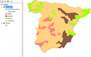
Join(s) tables to link the type of soil orders with their characteristics in the attributes table using ArcGIS.
To carry out this activity we will take Spain as an example. According to the Soil Taxonomy Classification established by the US Soil survey staff, we can find 4 types of soil orders in Spain. We will use a map where we appreciate these different types of soil orders but the only information that we have in the [...]

