
Multicriterial analysis to study erosion risk using ArcGIS
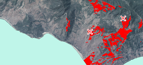
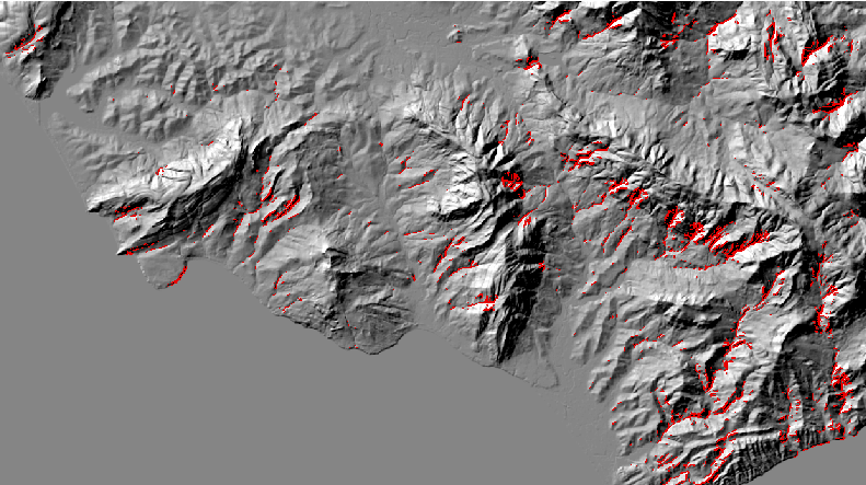
Today we are going to study the erosion risk of a terrain. With multicriterial analysis we are going to analyse the slope as well as its proximity to rivers. […]
Today we are going to study the erosion risk of a terrain. With multicriterial analysis we are going to analyse the slope as well as its proximity to rivers. […]
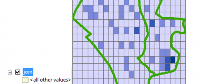
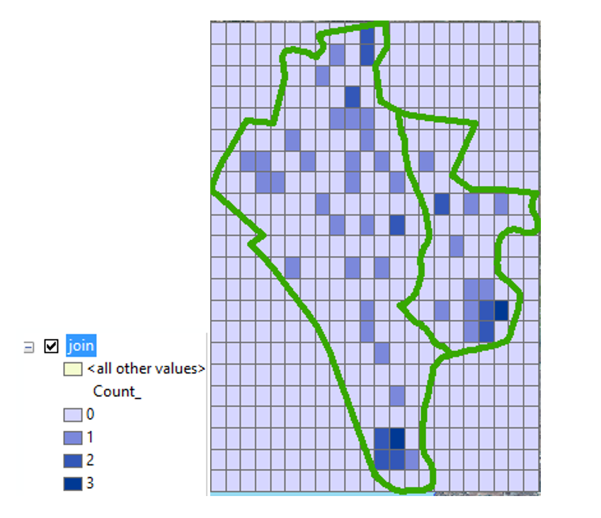
Many environmental projects need the design of presence or abundance maps in a fishnet (grid net). Following some simple steps we can represent in a grid the number of sightings of a species inside an area with colors that will vary depending on its abundance. […]
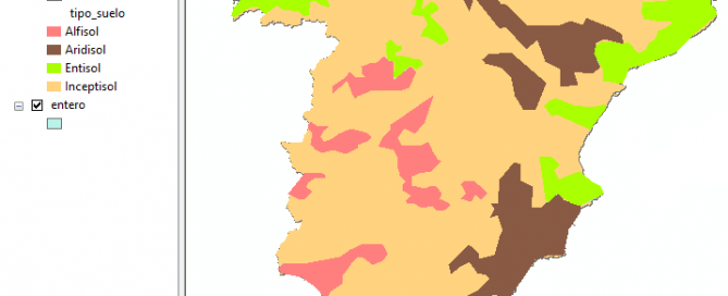
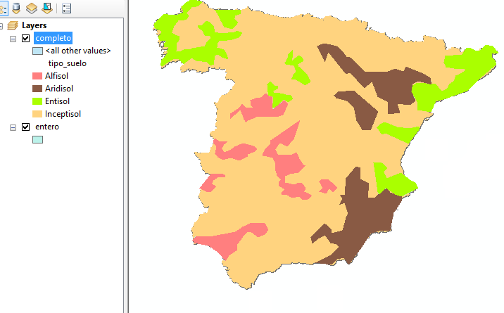
To carry out this activity we will take Spain as an example. According to the Soil Taxonomy Classification established by the US Soil survey staff, we can find 4 types of soil orders in Spain. We will use a map where we appreciate these different types of soil orders but the only information that we have in the [...]
By georeferencing we refer to the process of spatially adjusting a CAD drawing without modifying its original data. In ArcGIS, such process is done registering arbitrary points in the CAD drawing, therefore drawing known geographic coordinates. […]
ESRI launched the new ArcGIS 10.3 version with advanced features, available from any type of device. Let´s review some of its latest applications! […]
Following steps form our previous post, we will now visualize the viewsheds using ArcScene. […]
There exists the possibility to select those raster cells that comply with a certain criteria based in the values adopted by each of them. To do so, we will use this simple ArcToolBox tool “Extract by Attributes” that belongs to the tool group “Extraction” in the “Spatial Analyst” toolbox. […]
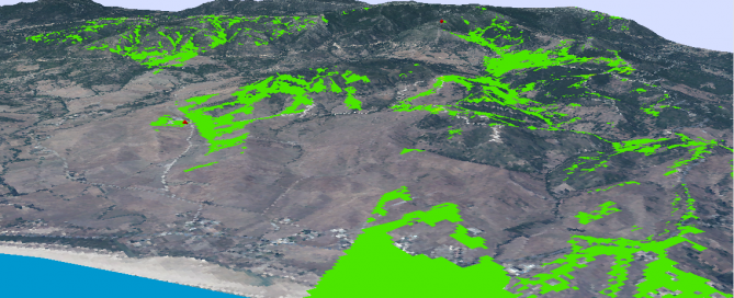
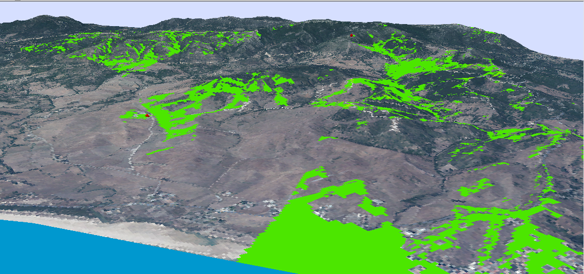
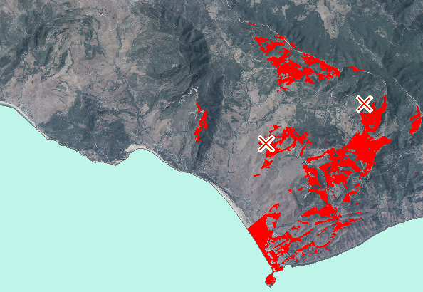
By generating Viewsheds we can determine which areas are visible form a certain point in a Digital Terrain Model (DTM). It defines the visibility that we obtain of a terrain from a specific observation point. […]
We have always heard about Open source inside the GIS sector, but when did they appear? what are they useful for? what is their future? […]
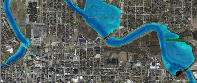
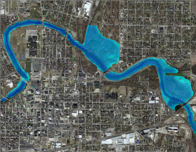
When we study a segment of a specific river to see where the water would flow if reached a certain value, different questions arise such as what will be the height reached by the water profile? Will surrounding areas be flooded? To what extent? It is not an easy task to answer these questions as we [...]


