As far as we are concerned, Global Climate is changing due to multilple factors, and we can measure all of them in the Atmosphere, oceans (temperature and acidification are the most remarkable), Cryosphere (iced poles) and sea level. And of course, global warming is the most noticeable one.

There are lots of studies that show everybody the present results of measurements from the past century. The main organism that publishes these results, is the IPCC (International Panel of Climate Change). This organism is a scientific body under the auspices of the United Nations (UN).
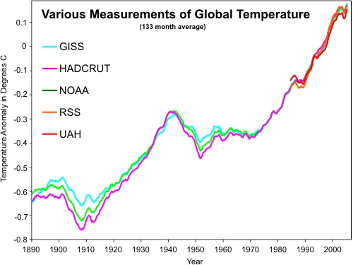
They have published graphs to comprehend the changing through the years, for instance, in temperature. We all know what shape has, and we are worried about that shape:

But, the most important thing: Do we really know everything about climate change? Can we answer, as biologists, ecologists, geologists, and all the professionals in environmental studies, the questions from the rest of the population? The answer to THIS question is .. “I have to dive into it”. We can’t know everything.
As we said, the IPCC studies many fields of climate change. But there are other webpages that take part of summarizing and explaining results and conclusions of a great deal of scientific studies.
One of these webpages is Skeptical Science.

Here, we introduce a link that drives you to the Global Warming and Climate Change Myths
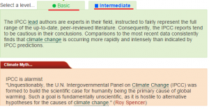
Click on the link. We are going to select one option: “IPCC is alarmist” (number 34). Click on the blue text to open the information.

We will find two different levels for the answer, even three in other issues. This means that there might be a simple discussion or a mathematical proof of the climate change.

So, for the next time somebody asks you, look for the answer on this website.
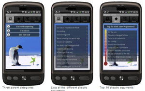
Furthermore, there is an application for iOS, Windows Mobile (Nokia) and Android, as well as a Firefox add-on. This includes the common questions about climate change.

The most visible effects of climate change are registered by satellite imagery. Every change through history since the photos taken by the satellites can be shown on maps, from global to regional.
In TYC GIS, we show how to elaborate proper maps, which tools are appropiate, and in different GIS softwares: gvGIS, QGIS and ArcGIS. Follow us on Twitter and Facebook, clicking on the buttons at the top of this post and sharing it.
Thank you for your attention!
See you at our courses.
Quality training taught by professionals
RECOMMENDED COURSE


Leave A Comment