Many environmental projects need the design of presence or abundance maps in a fishnet (grid net). Following some simple steps we can represent in a grid the number of sightings of a species inside an area with colors that will vary depending on its abundance.
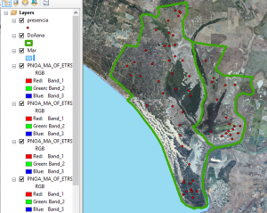
We need a point layer representing the presence of the species, correctly projected, and a map of the area that will be used as a guide.
Our goal is to determine the presence of a bird (seen or heard) through all Donana’s national park (Spain). (The data used is not real).
We will follow these 3 steps
- To generate a fishnet:
Data management tools > Feature class > Create Fishnet
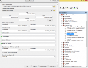
In the dialog box, select the new layer, where we want to save it and how we want to name it.
We can also specify the extension of the area. In this case we will choose the same area extent as the National Park.
In the following options we can decide how many cells the grid will have depending on the cell size (width and height) or, if this information is missing, on the number of rows and columns. You can also choose both options.
There is the option to select label points, this is, another point layer where each point appears in the middle of each grid cell. If not interested, unclick the box.
Finally we have to decide the geometry of the new layer, that can be polygon, as in this case, or polyline.
We will create a 25×25 grid net that extends throughout the whole area of the national park.
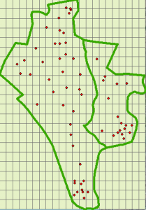
- Next we have to do a join of the net with the point layer.
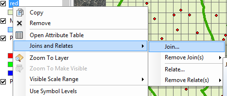
Right Click the generated net – layer and choose Joins and relates > Join.
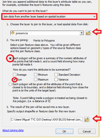
Select “Join data from another layer based on spatial location” and choose the layer to join to this layer.
Tick the first option and the option “sum”. Write down the name for this new layer.
- To modify the symbology of the layer:
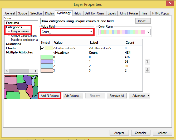
Right click on this new layer to select Properties > Symbology.
Indicate Categories > Unique Values and specify the field that will change its symbology.
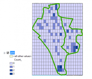
In the case of the Join this field will be “Count”. Choose “add all values”.
We will preferably decide any type of graduated color symbology as it is visually more outstanding.
The result will be something similar to this:

Quality training taught by professionals
RECOMMENDED COURSE


Hi, thanks for the tutorial. Is there any way I can make all grid cells within the national park boundary to be covered?