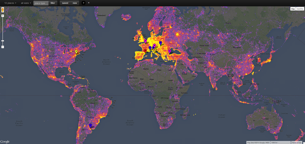
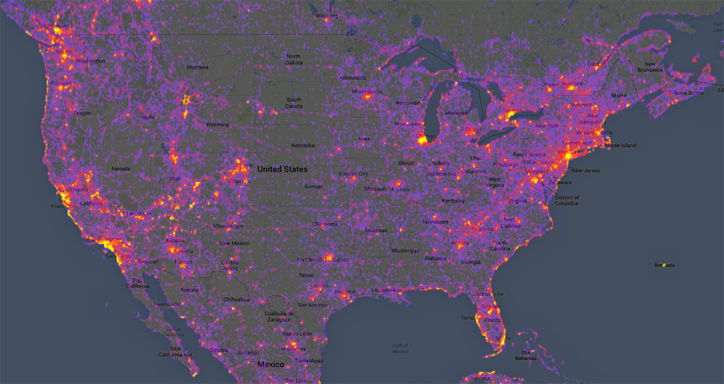
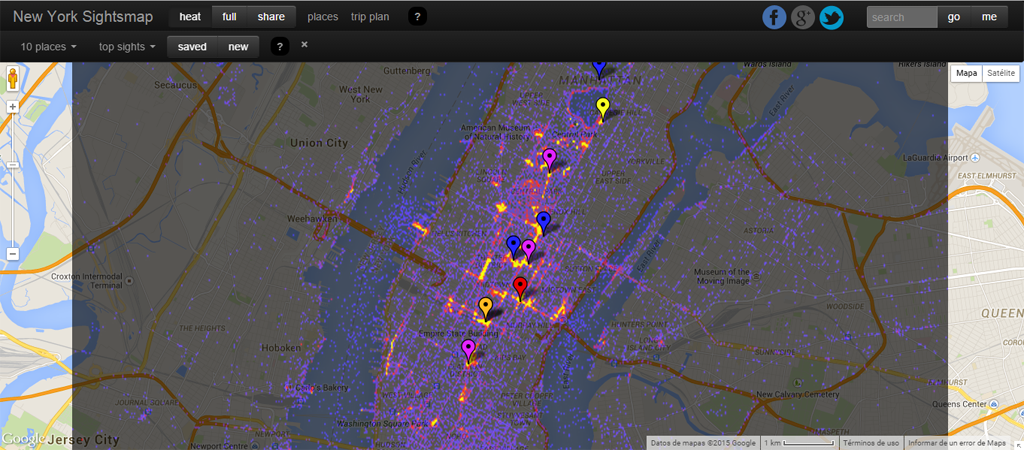
Sightsmap is a GIS that quantifies the most photographed places in the world through heat maps. This is, it generates high resolution heat maps that illustrate the number of pictures regarding sites worldwide.

As it can be seen, Europe concentrates the most photographed places. In contrast, we find areas like the Amazon, the north and center of Canada and Russia, the center of Australia, Central Asia (mainly countries in conflict) and almost the entire Africa, as the least photographed areas in the planet. This is explained due to their inaccessibility and hard living conditions, making tourism practically null.

United States of America is represented as the most photographed country, being New York City the most photographed city in the world.

The cities that follow New York as the most photographed in the world are mainly located in Europe: Rome, Barcelona, Paris, Istanbul, Venice, Monte Carlo, Florence, with exceptions like Buenos Aires that is included in this top 10 list, as number 9.
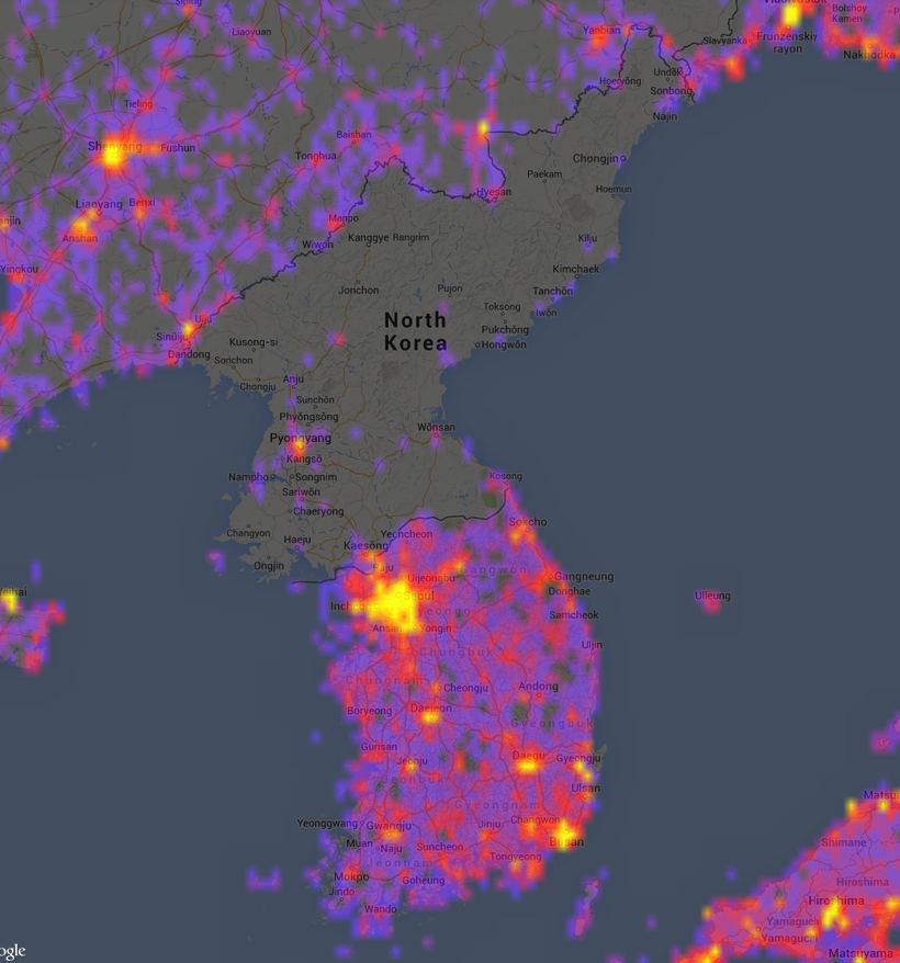
It is also worth mentioning other interesting images, as an example of world geopolitics, like in the case of Korea. While the South is too photographed, in the North even its capital Pyongyang remains hardly represented.

For more information about the project you can visit Sightsmap´s website.
Quality training taught by professionals
RECOMMENDED COURSE


Thanks Veronika, ineteresting map.
Where did you get the data about photographed location?